
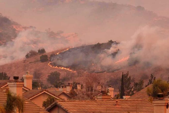
Homes are already burning in Southern California as four separate wildfires race through dry brush pushed by Santa Ana winds gusting up to 70 mph.
Story Snapshot
- Four named fires — Henderson, Bryson, Norte, and Peak — burned simultaneously across Southern California.
- The Norte fire burned roughly 250 acres and destroyed multiple homes in Orange County.
- Camp Pendleton issued an evacuation order as the Henderson fire grew past 1,400 acres.
- The National Weather Service kept a red-flag warning active amid peak winds of 50 to 70 mph.
- Interstate 5 temporarily closed as mandatory evacuations hit San Clemente and San Juan Capistrano.
Four Fires Burn At Once Across Southern California
Four fires broke out across Southern California within a short window of each other. The Norte fire burned about 250 acres and destroyed several homes. The Bryson fire covered roughly 200 acres. The Henderson fire grew to 1,404 acres and forced an evacuation order at Camp Pendleton. The Peak fire burned 43 acres before crews stopped its spread.
Los Angeles County’s emergency management office confirmed the National Weather Service issued a red-flag warning starting October 15. That same office tracked the Peak fire’s evacuation order being lifted once firefighters halted its forward movement, showing real-time coordination between weather forecasters and ground crews.
Santa Ana Winds Turn Brush Into Fuel For Fast-Moving Flames
The National Weather Service describes Santa Ana winds as strong, warm, dry gusts that blow downslope and can top 40 mph. Agency guidance says these winds can severely worsen brush and forest fires, especially when drought has dried out vegetation across the region. This is not a new pattern. It happens most years when fall conditions line up with dry fuel.
Forecast data issued during this outbreak described moderate to strong Santa Ana winds spreading across the region, with peak gusts reaching 50 to 70 mph. Forecasters kept red-flag warnings in place across Southwest California because those wind speeds, combined with low humidity, created critical fire weather. Officials did not treat the warning as proof a fire existed, but as a signal that any ignition could spread fast.
Evacuations And Road Closures Hit Thousands Of Residents
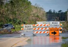
Mandatory evacuation orders went out in San Clemente and San Juan Capistrano as flames pushed toward neighborhoods. Camp Pendleton, the Marine Corps base, issued its own evacuation order as the Henderson fire expanded. Interstate 5, a major highway linking San Diego and Los Angeles, closed temporarily because of fire activity near the roadway.
These impacts show the fires reached far beyond empty hillsides. Families left homes on short notice. Drivers got rerouted around a closed interstate. Marines at a working military base had to evacuate buildings. The scope of these disruptions reflects how fast wind-driven fires can threaten infrastructure that millions of people rely on every day.
Why Fire Numbers Keep Shifting And What That Means
Acreage and containment figures changed across different updates. Henderson appeared at 1,117 acres in some reports and 1,404 in others. Bryson ranged between 147 and 200 acres depending on the source and the time of the report. Fire perimeters move fast during high winds, so updated numbers usually reflect real growth or containment progress, not conflicting accounts of the same moment.
Windy conditions are present across the Southwestern U.S. today. In Southern #California, strong Santa Ana winds encourage the growth of wildfires that have ignited along the coast. Thank you, @CIRA_CSU ! https://t.co/DsjoJSsiIT
— Peter the Great Space Science☀️ (@Space_PHD) October 17, 2026
Research on Southern California fire behavior points to a broader truth behind these events. A United States Geological Survey analysis found that the number of fire ignitions and wind speed, not temperature or rainfall, are the strongest drivers of how much land burns during Santa Ana wind events. That finding matters because it separates two different questions people often blend together: what makes a fire spread, and what causes a fire to start in the first place. The available record confirms wind drove rapid spread across all four fires. It does not establish what sparked each one. Agencies have not yet released origin-and-cause reports, so residents are left trusting incident commanders on the ground while official investigations continue. For now, the clearest fact is this: strong winds met dry land, and four fires grew fast enough to empty neighborhoods and shut down a major highway in a matter of hours.
Sources:
facebook.com, fire.ca.gov, latimes.com, lacounty.gov, marine.weather.gov, en.koreadaily.com